

Shop
“Rare Vintage ‘Hebrew Land’ Map – Jewish National Fund Poster” Printed in Jerusalem 1920s
$1,750.00
SOLD
| Artist / Creator | |
|---|---|
| Year | |
| Condition | |
| Size | |
| Technique | |
| A |
Description
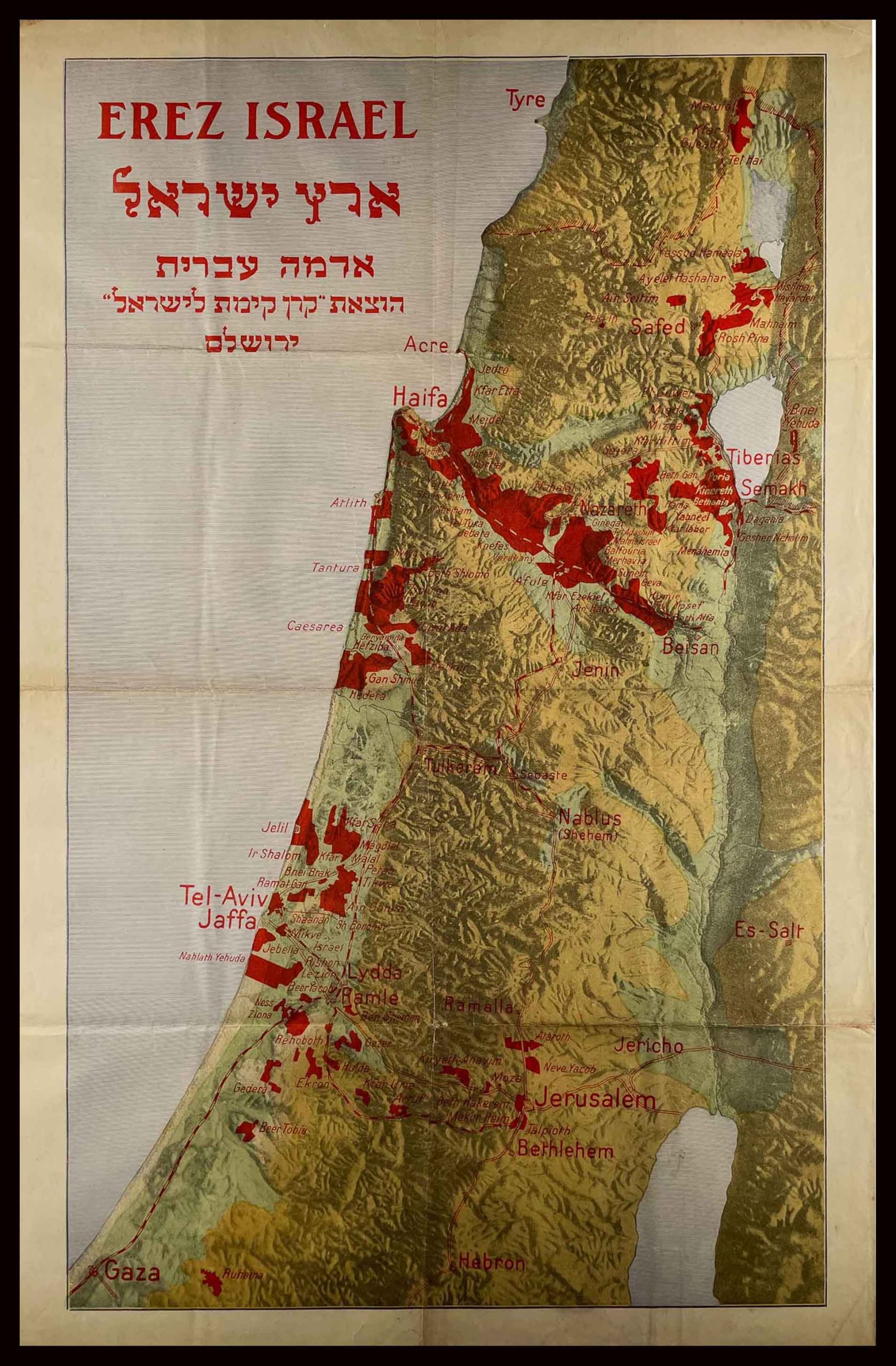
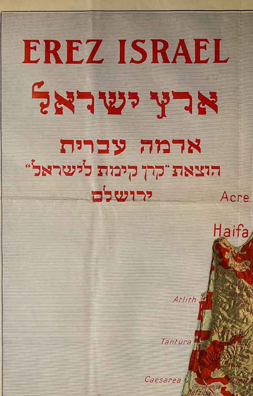
**Vintage “Erez Israel – Hebrew Land” Map
-
“Rare 1920s Vintage ‘Hebrew Land’ Map – Jewish National Fund Poster”
Jewish National Fund (JNF) – ca. 1920s – Lithograph – Rare Zionist Poster**
A rare and authentic vintage lithographic map published by the Jewish National Fund (Keren Kayemeth LeIsrael) in Jerusalem during the early 1920s.
This historically significant poster highlights, in vivid red, the lands acquired for Jewish settlement — presenting a clear visual record of early Zionist land-acquisition efforts prior to the establishment of the State of Israel.
Historical Significance
This map is especially important because it represents one of the earliest documented uses of the concept and terminology “Hebrew Land” (“Adama Ivrit”) within the Zionist movement.
The phrase expressed the ideological aspiration to establish a national Jewish homeland not only in spirit but through concrete land ownership — a foundational principle of early Zionist nation-building.
What the Map Shows
Covering the full span of Western Palestine/Israel — from the Galilee to the southern coastal plain — the map marks in red the Jewish-owned or JNF-acquired lands.
Highlighted regions and early Jewish settlements include:
-
Galilee: Safed, Rosh Pina, Metulla, Tiberias, Yavne’el, Kinneret, Degania
-
Jezreel Valley: Nazareth, Afula, Nahalal, Ginegar, Givat HaShlosha
-
Coastal Plain: Tel Aviv, Jaffa, Petach Tikvah, Rishon LeZion, Ness Ziona, Rehovot
-
Jerusalem Area: Early neighborhoods such as Rehavia, Talpiot, Beit HaKerem
-
Southern Region: Early agricultural settlements and the Gaza district (geographically marked)
Details
-
Period: circa 1920s
-
Publisher: Jewish National Fund (JNF), Jerusalem
-
Technique: Lithograph
-
Type: Vintage Poster / Map
-
Condition: Good vintage condition, with original fold lines
-
Size: 66×42 cm / 26×16.5 in
מפת קרן הקיימת פוסטר כרזה שנות ה20 אדמה עברית ישראל פלסטינה הודפס בירושלים
All our products are 100% original
World Wide Free Shipping
The Farkash Gallery packs each item professionally. We work with the leading postal companies - UPS, FeDex etc. When
shipping internationally, the buyer is responsible for any customs, duties, or taxes that are set by your destination
country.
Delivery
Estimated Delivery Time is 7-14 days.
Payments
PayPal - Visa, Mastercard, American Express, Discover
Returns
Returns accepted if product not as described. Buyer pays return shipping fee.
100% Money back guarantee (Not including shipping costs)
Guarantee
Money Back Guarantee. Get the item you ordered or get your money back. Buy with confidence.
Related Products
-
Tel Aviv Zoo Here we Are! illustrated poster, 1938- Vintage Israeli Poster.
$0.00 -
031st Israeli Independence Day Vintage Poster Israel 1979 (The Small version)
$1,400.00 Buy Now -

Vintage Israeli Poster – Kesem Washing Powder by Franz Kraus Palestine Eretz Israel FRANZ KRAUS 1930s
$5,500.00 Buy Now -
022nd Israeli Independence Day Vintage Poster Israel 1970
$2,800.00 Buy Now
