פוסטר ישראלי וינטג׳, פוסטר הסברתי ישראלי, פוסטר ממשלתי ישראל, מלחמת ששת הימים 1967, גבולות 1967, הקו הירוק, ישראל לפני 1967, פגיעותה של ישראל, עומק אסטרטגי ישראל, מפה פוליטית ישראל, מפה ביטחונית ישראל, מפה היסטורית ישראל, הסברה ישראלית, ישראליאנה, אספנות ציונית, מסמכי הסברה מדינית, פוסטר היסטורי ישראל, תל אביב בטווח אש, ירושלים בטווח ארטילריה, נתב״ג יעד אסטרטגי, איום טילים על ישראל, איראן איום על ישראל, ישראל ומדינות ערב, היסטוריה ביטחונית של ישראל, תיעוד מלחמת ששת הימים, תצוגה מוזיאלית ישראל, פוסטר חינוכי אקדמי,
Vintage Israeli poster, Israeli propaganda poster, Israeli government poster, Six-Day War 1967, pre-1967 borders, Green Line Israel, vulnerability of Israel, historical Israel map, Israeli military map, Israeli political map, Cold War Middle East poster, Israel before 1967, strategic depth Israel, missile threat to Israel, artillery range map, Tel Aviv within firing range, Jerusalem strategic vulnerability, Ben Gurion Airport target map, Iran threat Israel, Middle East geopolitics, Israeli public diplomacy, Zionist historical poster, museum-grade Israeli poster, rare Israeli map poster, Israel survival narrative, Israel then and now security, explaining the Six-Day War, geopolitical explanatory poster.


Shop
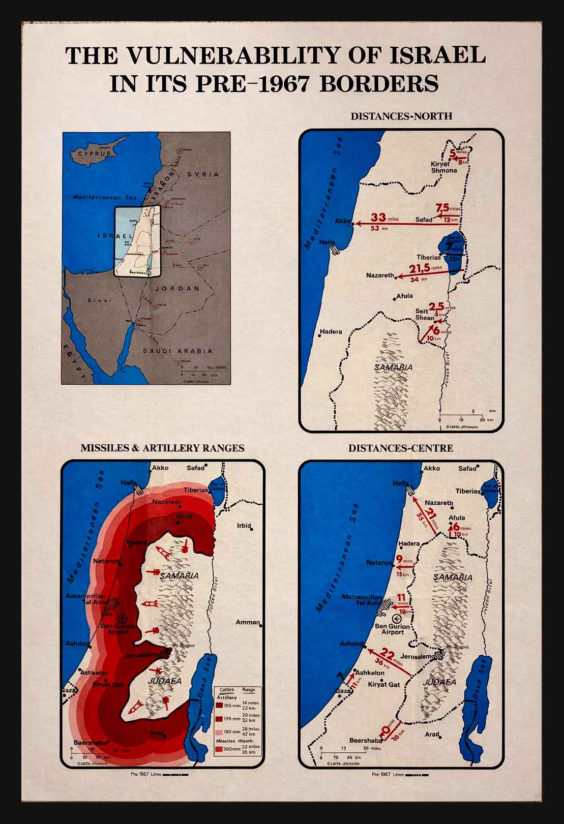
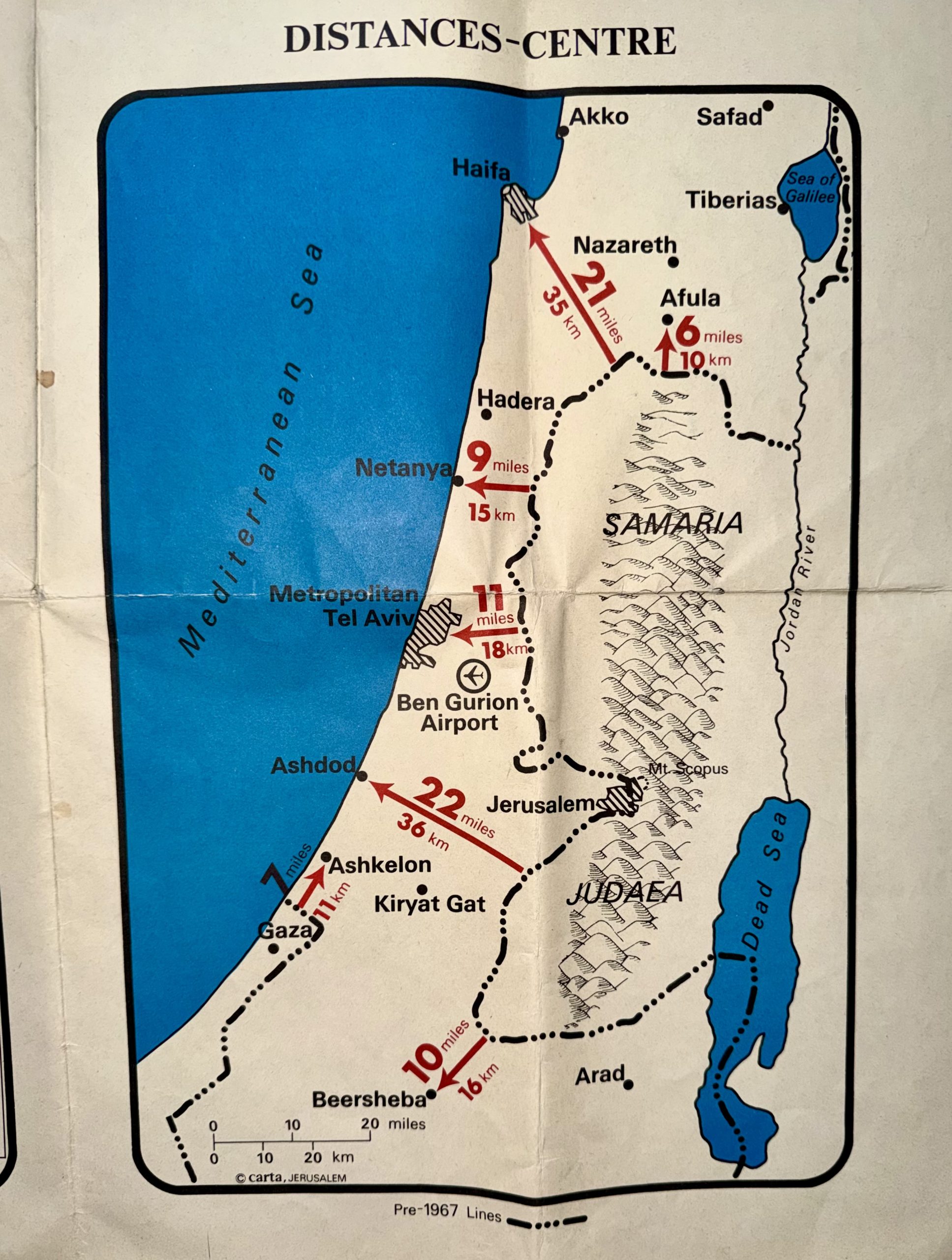
“The Vulnerability of Israel Before 1967 – Rare Official Israeli Explanatory Vintage Map Poster”
$2,400.00
1 in stock
| Artist / Creator | Israeli Ministry of Foreign Affairs, Public Diplomacy Division |
|---|---|
| Year | |
| Condition | |
| Size | |
| Technique |
Description
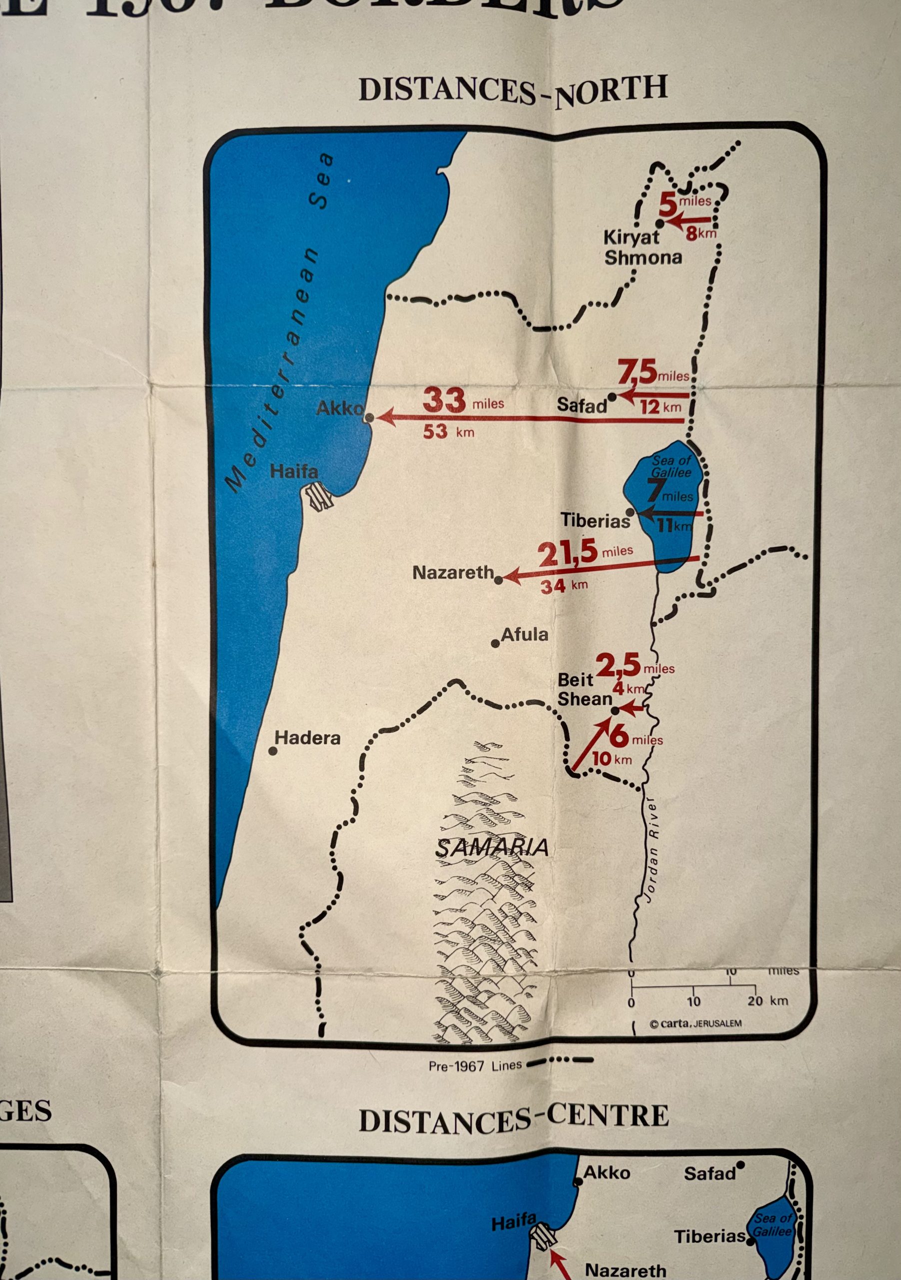
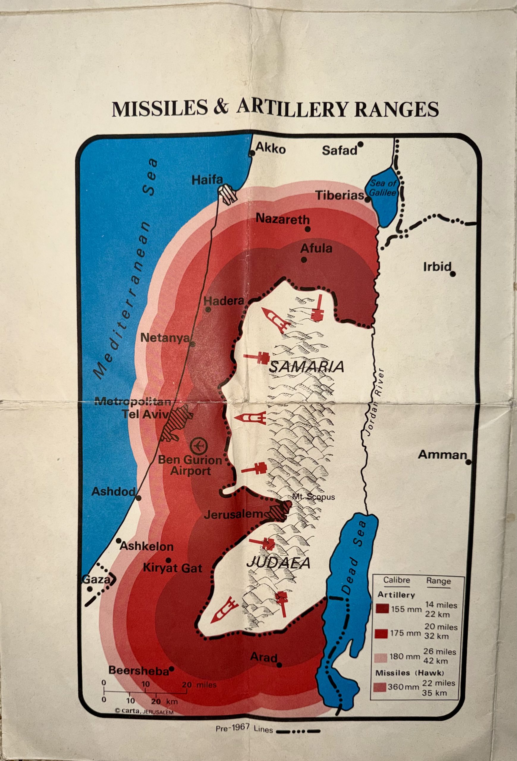
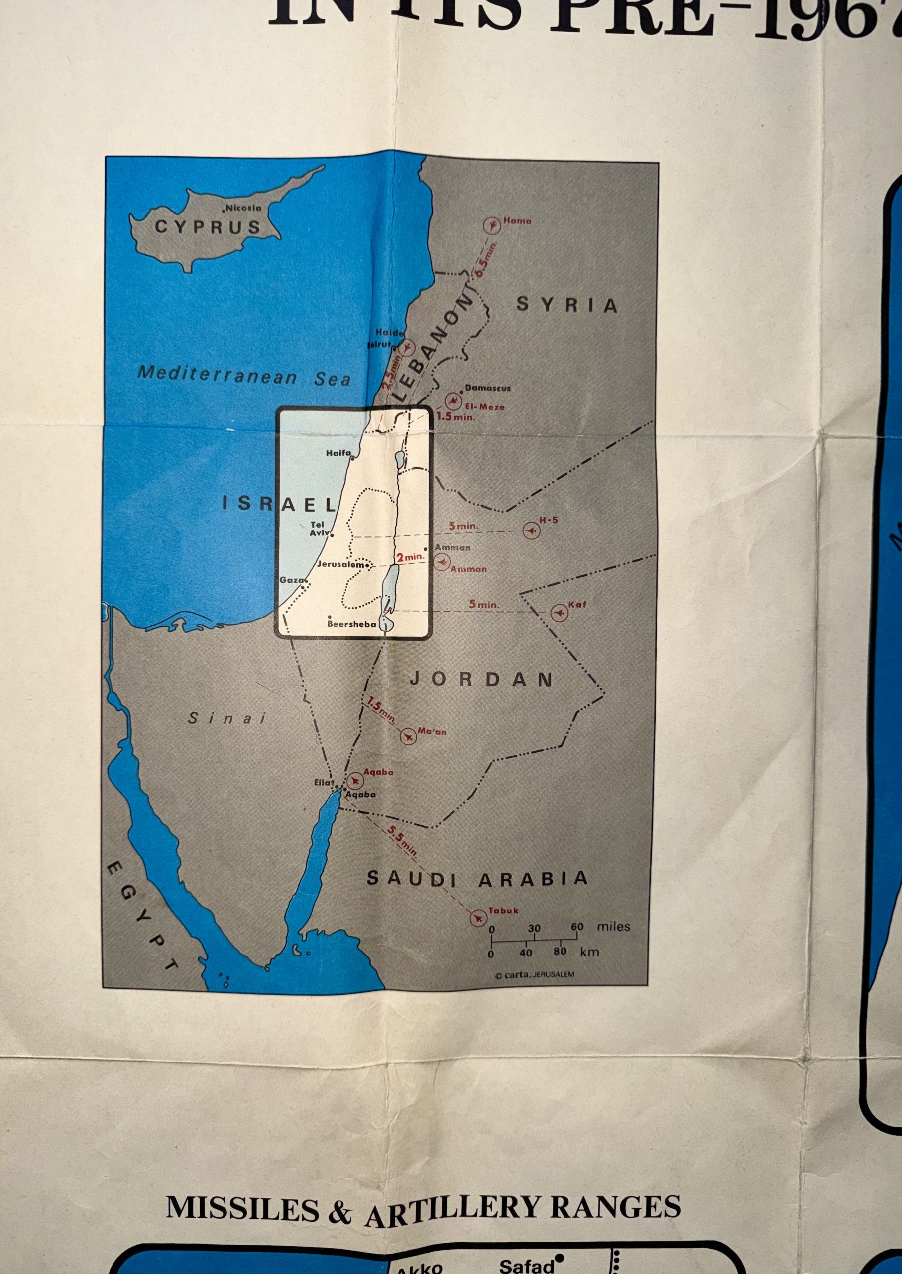
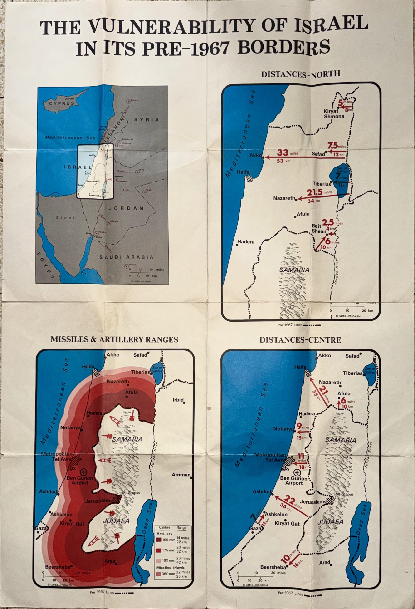
“The Poster That Explained a War: Israel’s Pre-1967 Borders and the Fight for Survival”
All our products are 100% original
World Wide Free Shipping
The Farkash Gallery packs each item professionally. We work with the leading postal companies - UPS, FeDex etc. When
shipping internationally, the buyer is responsible for any customs, duties, or taxes that are set by your destination
country.
Delivery
Estimated Delivery Time is 7-14 days.
Payments
PayPal - Visa, Mastercard, American Express, Discover
Returns
Returns accepted if product not as described. Buyer pays return shipping fee.
100% Money back guarantee (Not including shipping costs)
Guarantee
Money Back Guarantee. Get the item you ordered or get your money back. Buy with confidence.
Related Products
-

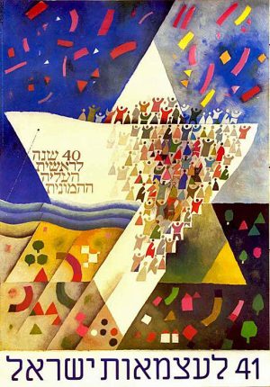
42nd Israeli Independence Day Vintage poster israel 1990 (The Big Version)
$1,800.00 Buy Now -
041st Israeli Independence Day Vintage Poster isral 1989 “40 years of mass immigration”
$1,450.00 -

044th Israeli Independence Day Vintage Poster israel 1992
$1,100.00 Buy Now -
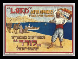
Rare Vintage Israeli Poster Lord Jaffa Oranges Ze’ev Raban,Bezalel 1920
$0.00